About Us
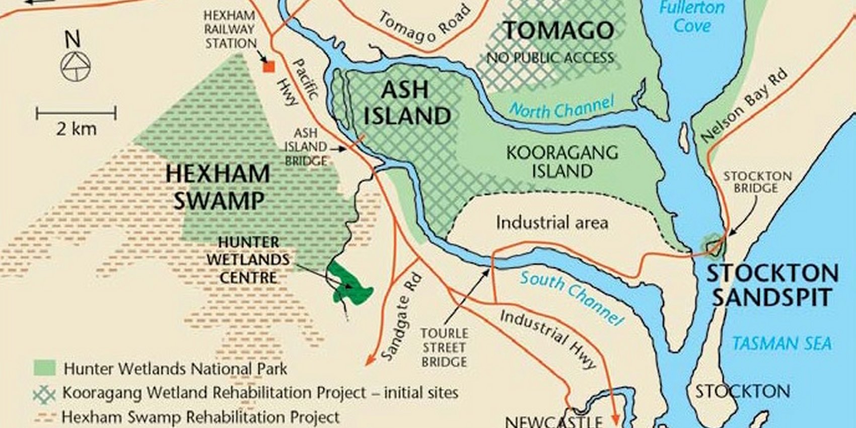
Ash Island
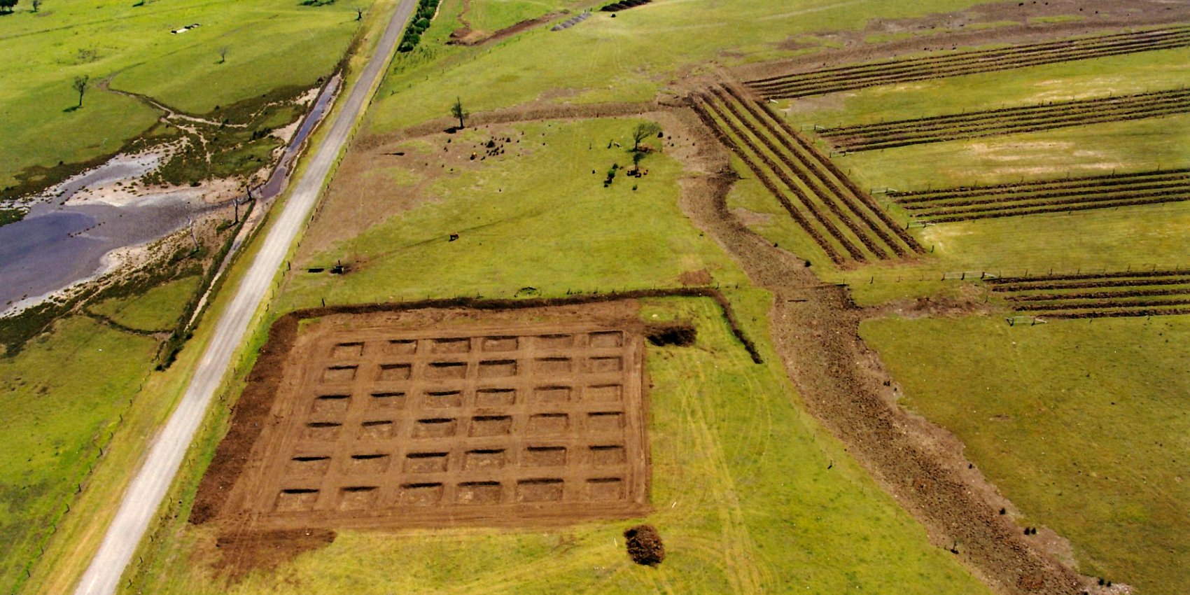
The history of the Hunter River estuary is the history of the Kooragang Wetlands. Scattered throughout this landscape are structures that hint of Ash Island’s more recent European past which includes dairy farming, surveillance capabilities during World War II and a community large enough to support a two teacher school. We have restored a number of these sites so we can use the structures to indirectly assist habitat restoration works.
Pre Industrial
Before the 1800’s there were 10 islands in the delta, some not named. Carrington was known as Bullock Island. Ballast from sailing ships filled in the northern canal making it part of the mainland which was renamed Carrington. Spit Island was a small island in front of what became the BHP steel making plant. The waste from the plant filled in the channel making it part of the mainland. Moscheto, Dempsey and Ash Island are now known as Kooragang Island.
Timber Getting Era
” STOCKTON, the oldest suburb of Newcastle, can trace its origin back to the day when the Hunter River was discovered by Lieutenant John Shortland, for he landed on three parts of the peninsula.
Its first title was “Pirate’s Point”, due to the fact that in 1800 a gang of escaping convicts, who had seized the small vessel “Norfolk” in Broken Bay and were making their way northwards, were wrecked upon the point of the peninsula.
Hunter River Estuary
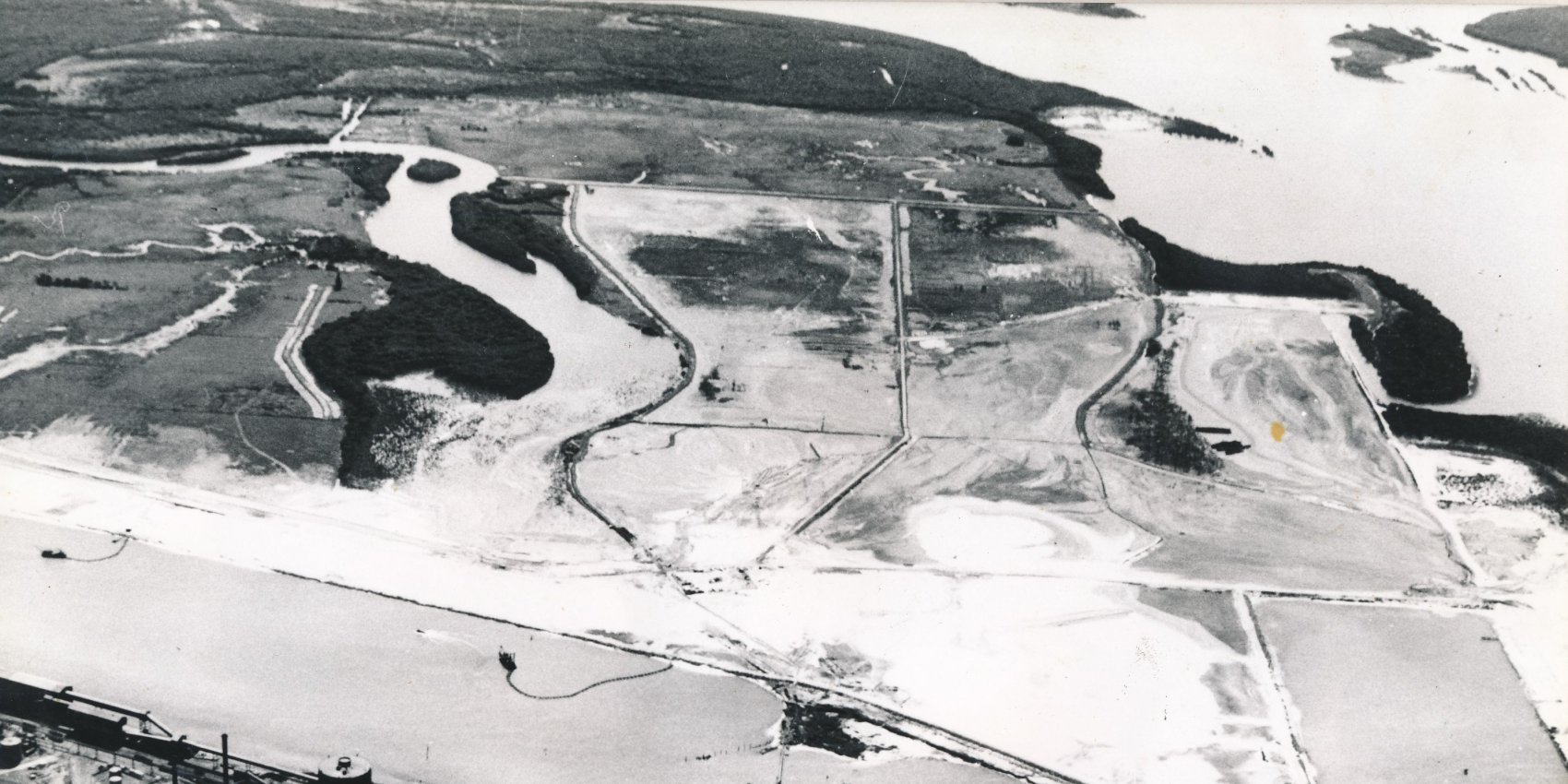
At first glance, the Hunter River estuary near Newcastle NSW is a land of contradictions. It is home to one of the world’s largest coal ports and a large industrial complex as well as being the location of a large internationally significant wetland. The remarkable natural productivity of the Hunter estuary at the time of European settlement is well documented. Also well documented are the degradation and loss of fisheries and other wildlife habitat in the estuary due to over 200 years of draining, filling, dredging and clearing (Williams et al., 2000).
Farming Era
One of the most important, and certainly the most neglected portion of the Newcastle district is that made up of the three large islands formed by the delta of the Hunter River. Although each of these islands is within the ten miles radius, they are as little known to the majority of the people of the city as if they were situated at Port Stephens or Barrenjoey.The reason is that they can only be reached by water, and being settled with a quiet farming population, nothing is ever heard from them.
Development Timeline
1796 – Fishermen driven ashore find coal littering the beach near the unnoticed mouth of the Hunter River (Perry 1963).
1797 – Discovery of the mouth of Hunter River by Lt. J Shortland when directed by Governor Hunter to recapture convicts escaped from the Sydney settlement (Coffey 1973). Subsequently, two commercial vessels visit the river, one of which carries coals and cedar to Sydney (Perry 1963).
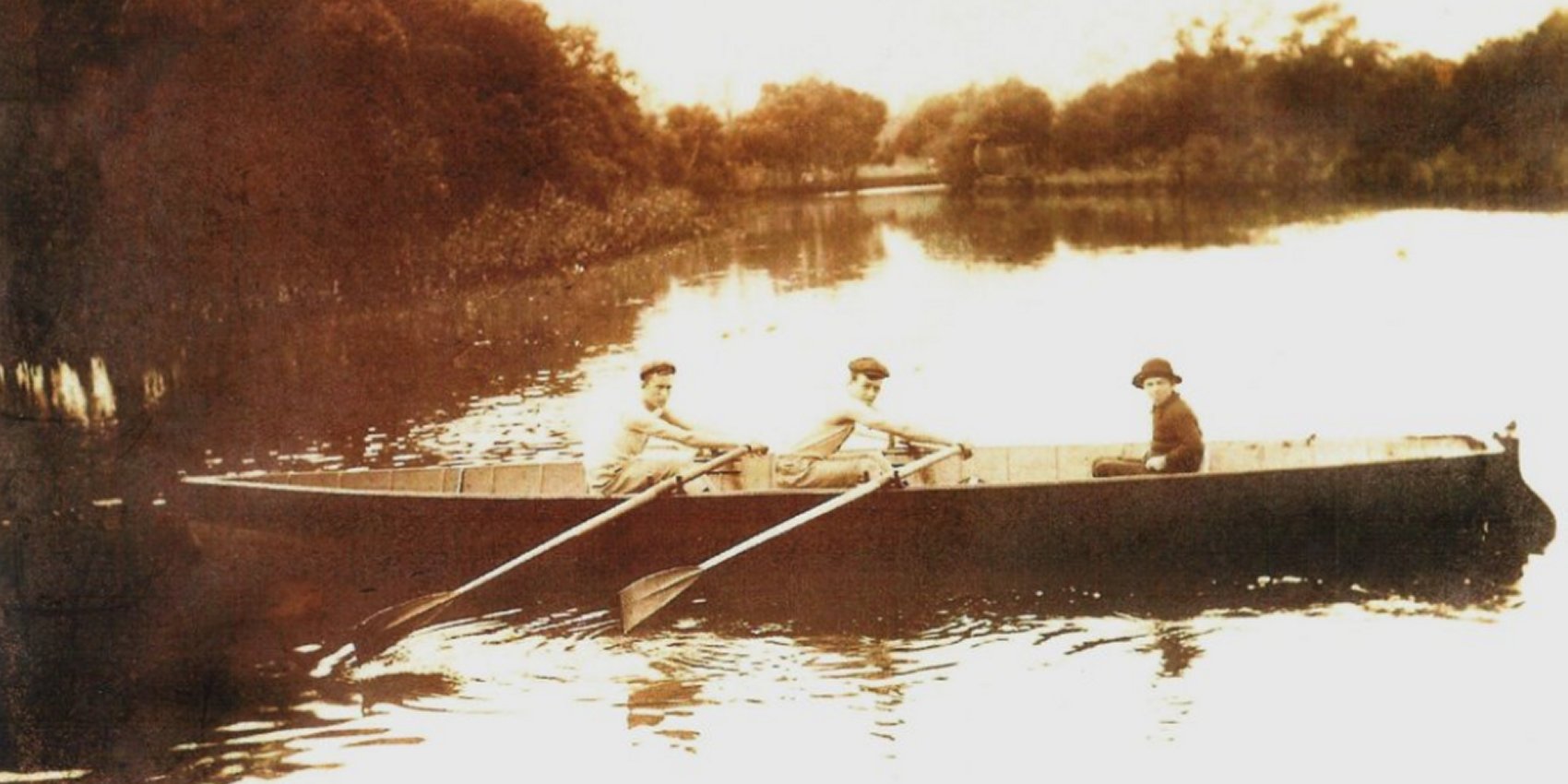
Butcher Boats
In the late 1800s and the first decade of 1900 when a sailing ship arrived in port after a lengthy voyage her food stocks were usually depleted. These were the great days of sail for Newcastle Harbour with the port crowded with ships from all over the world waiting their turn to dump ballast and load coal photographic evidence revealing at Stockton they were sometimes moored 3 abreast at The Ballast grounds.
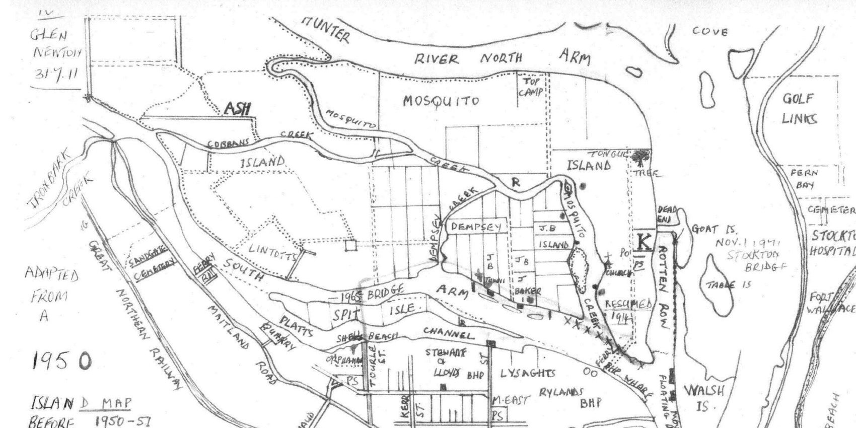
Moscheto Island
Moscheto Island is one of the landmarks of the Hunter River. It has been that for a hundred years, and for more than half that period Newcastle drew from it much of the fruit, vegetables, and dairy products that were required for its daily needs. In the early stages of the island’s history, its activities were three in number, being confined to vegetable and fruit culture and fishing.

A Land of Plenty
It was one of several Hunter River islands and for many years it was the source of Newcastle’s milk supply. For a period, before the coming of industries, it also supplied residents with fruit and vegetable.
Moscheto Island, or Mosquito Island as it was also known, is today part of Kooragang Island but there was a time when it was very important to the fledgling city of Newcastle. In its early years of settlement Moscheto Island produced the first locally grown fruit. The soil and temperate climate were ideal for growing oranges, apples and peaches.
Indigenous Inhabitants
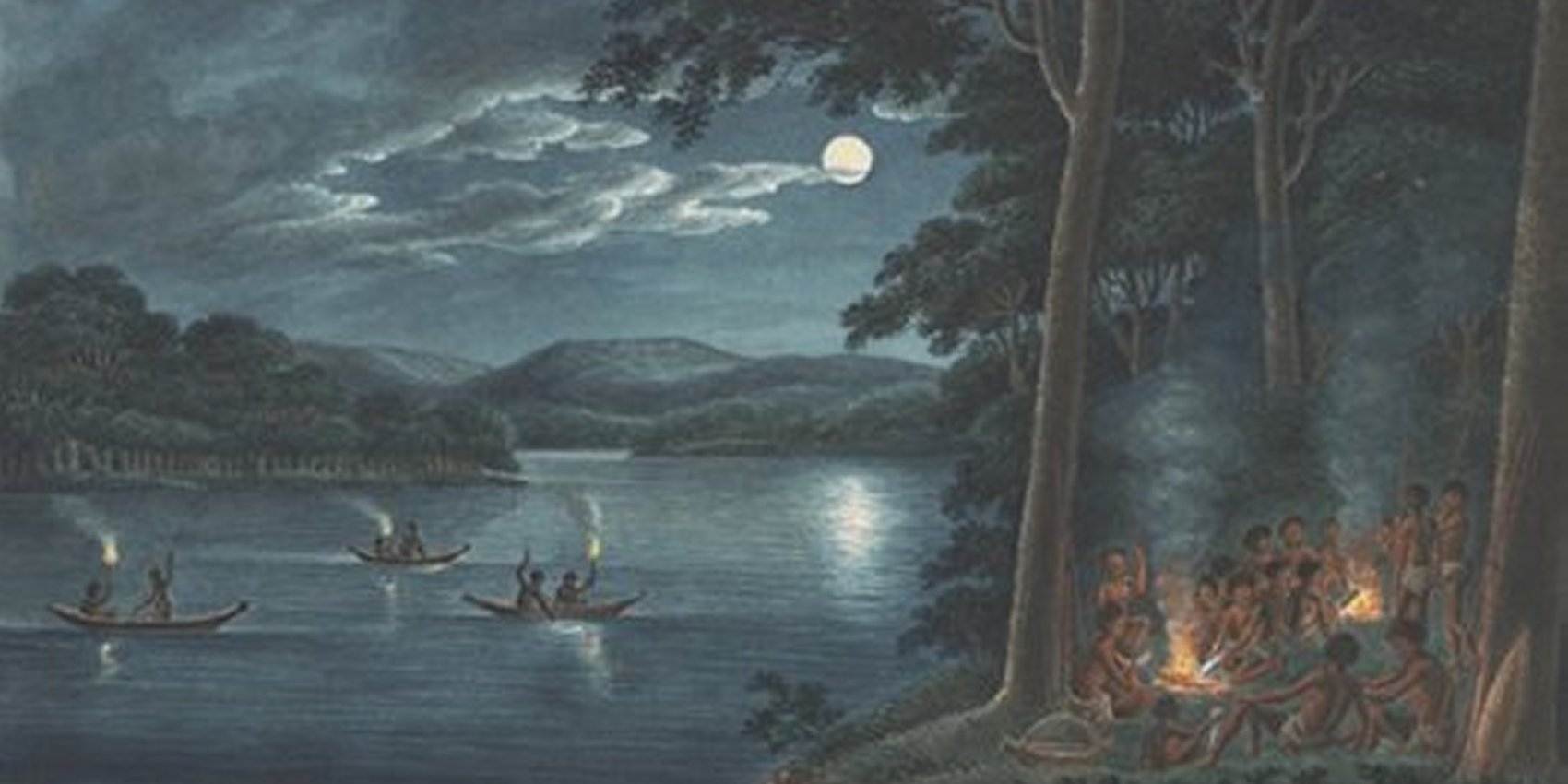
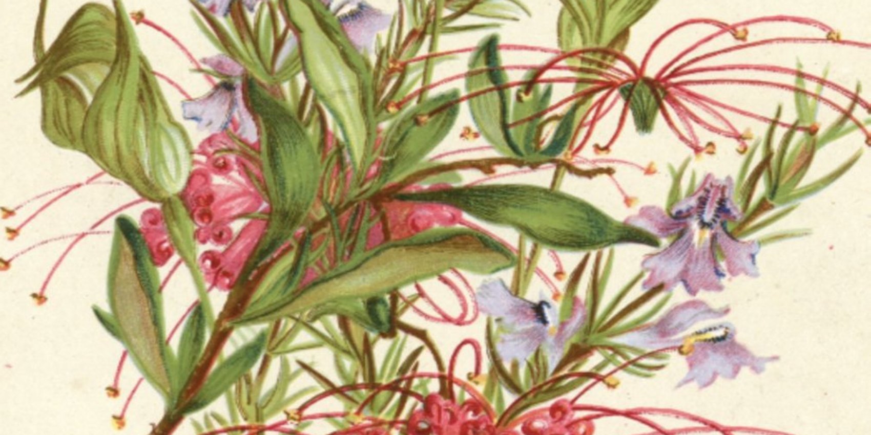
Aboriginals camped on the riverbank of the Hunter River for thousands of years until approximately 1860 when their traditional way of life was interrupted and overwhelmed by European settlement. The Aboriginals must have regarded the Island as a paradise with the river teeming with aquatic life and the land rich with game. From many accounts it appears that both the nomadic Awabakal and the nearby Worimi Tribes used Ash Island as literally a supermarket thoroughfare where they stopped when going from place to place to replenish their supplies, harvesting available food sources on their journey up and down the river and west to Sugarloaf across the Hexham Swamp.
Moscquito and Dempsey
In the very early days of the history of Newcastle, the islands in Port Hunter were occupied by settlers, who combined timber-getting, fishing, and market gardening. The occupation of the islands has undergone an evolutionary process, and to-day practically all the indigenous timber has been cleared, and the land is chiefly occupied by dairy farmers, who find a ready market for their milk in the city.
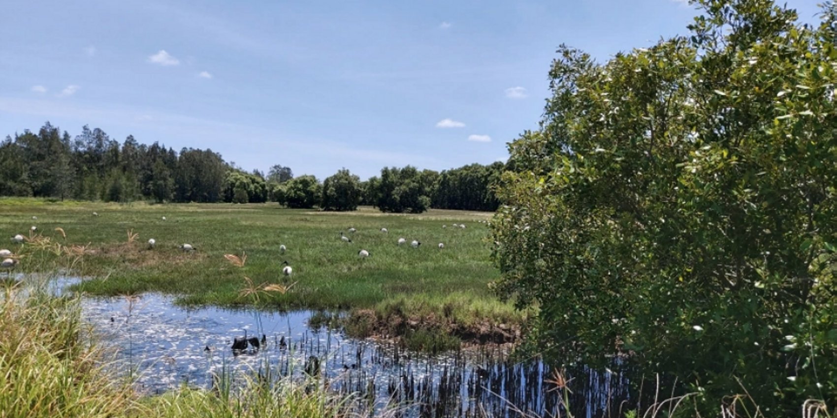
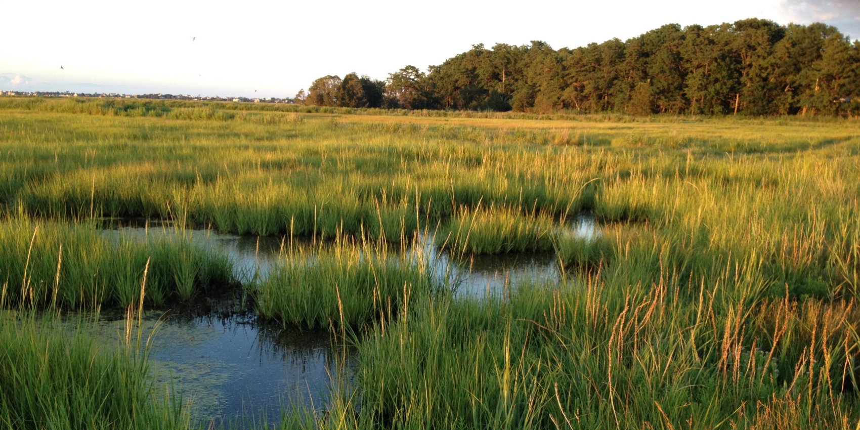
Kooragang Wetlands
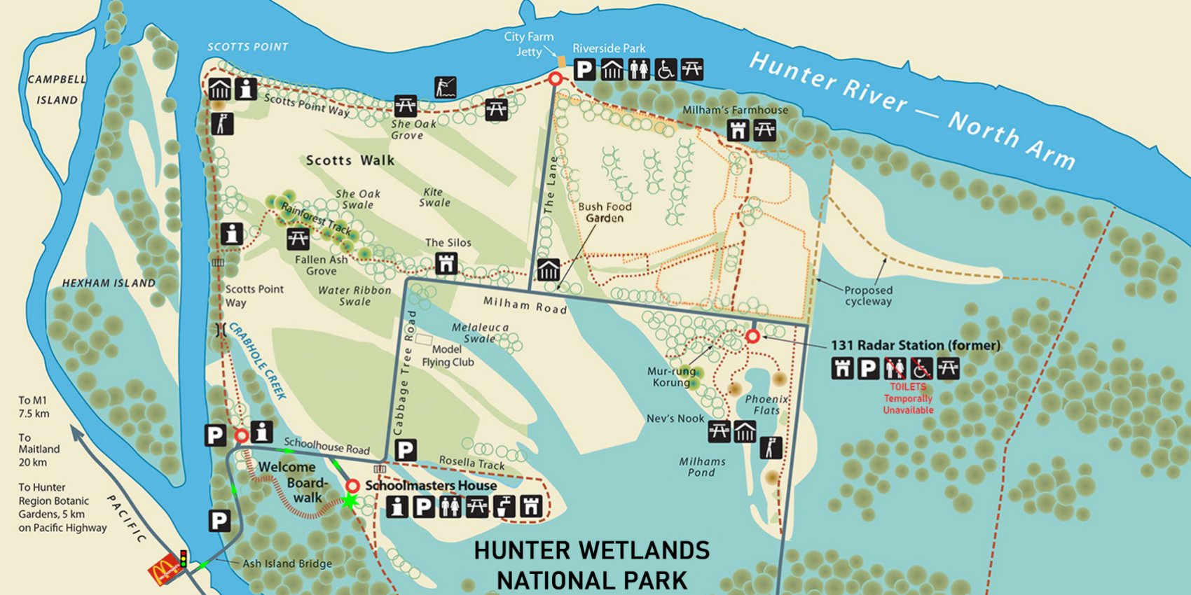
Kooragang Wetlands (Ash Island) is accessed via the Ash Island Bridge, 100 m east of McDonalds on the Pacific Highway at Hexham (12 km west of Newcastle). From Sydney, take the F3 north to the end of the Freeway. Turn right towards Newcastle and travel 7.5 km along the Pacific Highway until you reach the Ash Island Bridge.Experience and explore the wide open spaces along 15 km of boardwalks, cycleways and walking tracks.
Ash Island History
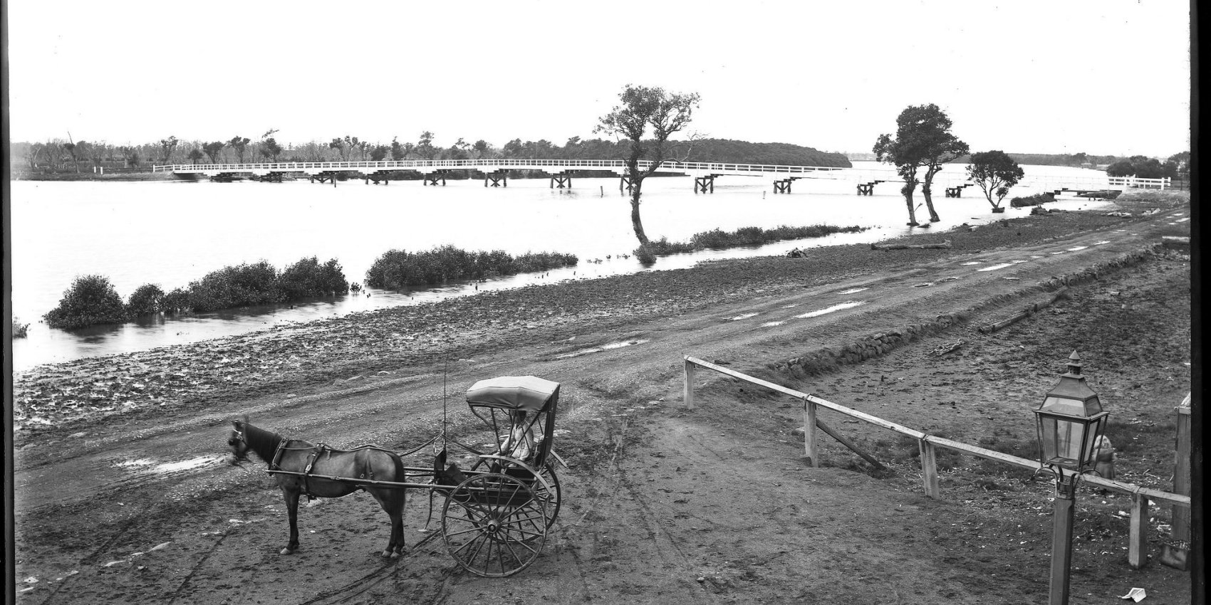
Ash Island was once one of a number of islands and mudflats found in the Hunter River estuary near Hexham. Today it is part of the larger island known as Kooragang Island. It has an interesting history of occupation and use. The islands of the Hunter River estuary have a long history of occupation. For thousands of years the Worimi and Awabakal people hunted, fished and collected food from the area, well supplied by the abundant flora and fauna that included water birds, shellfish, wetland plants, mammals and fish.The islands in the estuary, including Ash Island, were explored and surveyed by Europeans in 1801.
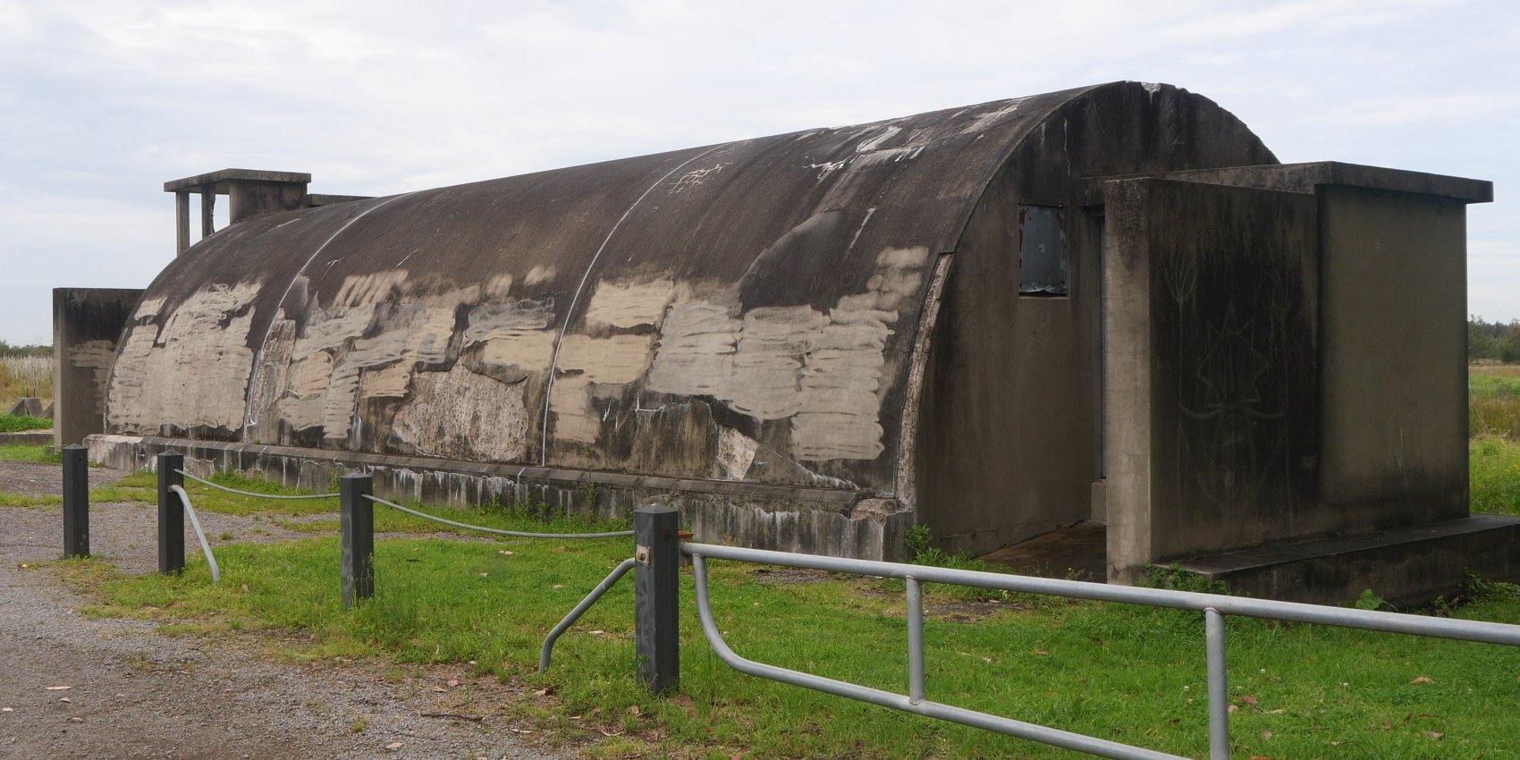
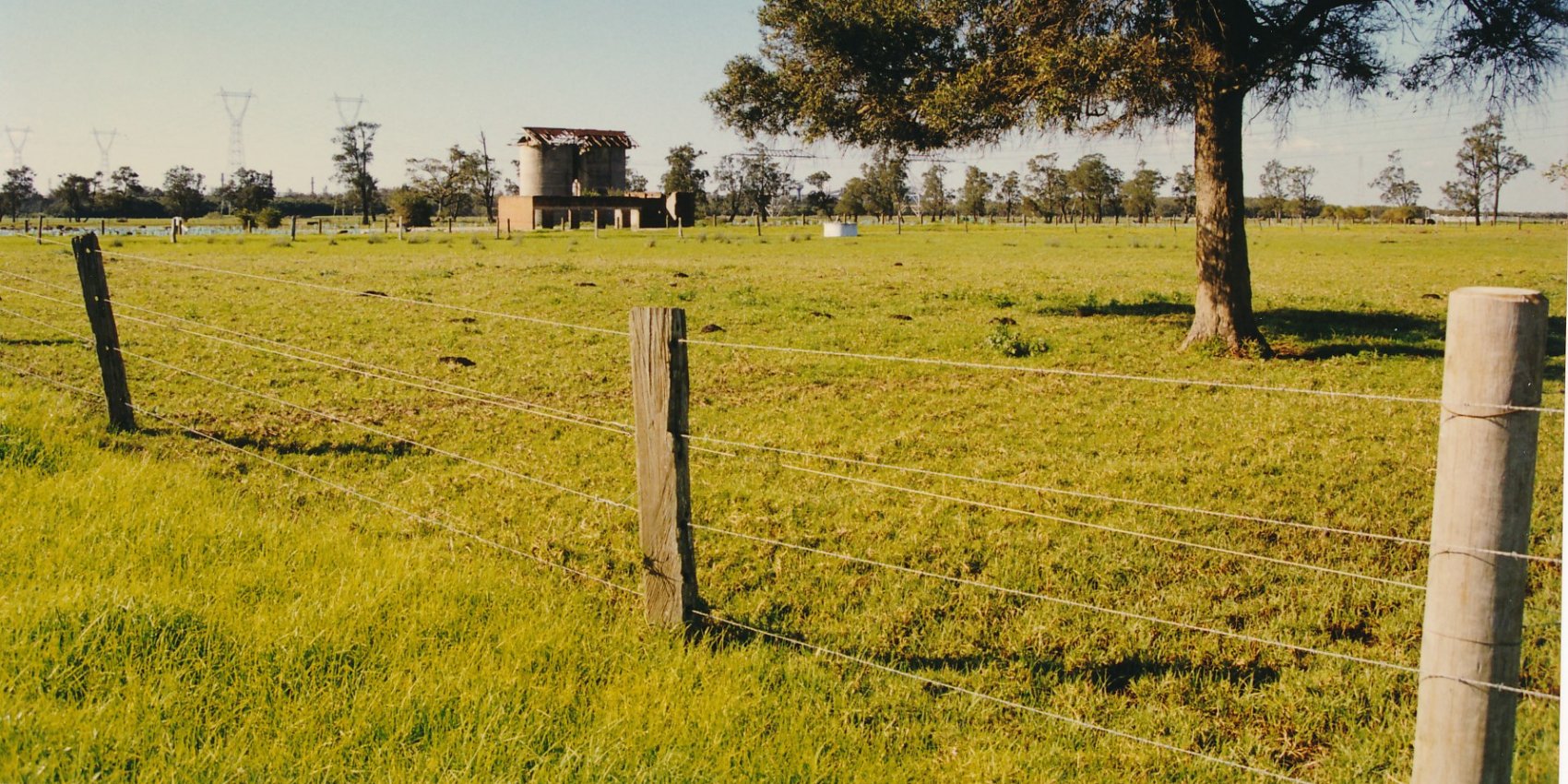
131 Radar Station
131 Radar on Ash Island was fairly typical of the small RAAF stations on watch along the east coast of Australia, set up quickly when the threat of enemy action was at its greatest. A very early Ground Control Interception (GCI) unit – formed in 1942 with English mobile equipment and an all male complernent, the station was on watch over Newcastle for several years during which time its equipment was changed twice – finishing its service in 1945/46 with the most modern Canadian GCI set, well protected in an almost impregnable concrete igloo operations room.
Visitors to Ash Island
What is the most valuable Australian wine? Many will automatically say Penfold’s Grange Hermitage. A collection of 40 vintages, from 1951 to 1990, has sold at auction for $138,000. That’s a staggering $3450 for each bottle. But what is the greatest impact on the desirability of a bottle of wine? Afficionados of the wine industry say that a wine that is very rare and difficult to find will push the demand, and the price, higher.
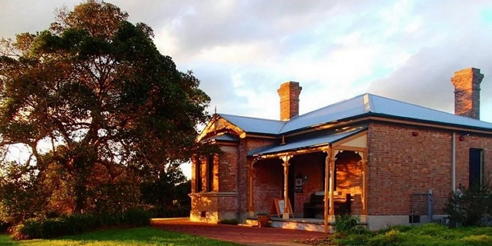
School Masters House
The Schoolmasters house has local heritage significance. It was built in the mid 1890s to house the schoolmasters who administered and taught at the Ash Island Public School located a short walk to the west. The house has stood through floods, been the home for many tennants and during World War II was leased by the RAAF. Sturdily built of double brick, the house has Baltic Pine ceilings, tallowwood floors, cedar doors and windows, and three marble fireplaces.