A list of dates relevant to the change of wetland habitats at Kooragang Island and elsewhere in the lower Hunter River.(Reprinted with permission from Williams, R.J, F.A. Watford and V. Balashov. (2000) Kooragang Wetland Rehabilitation Project: History of Changes to estuarine Wetlands of the Lower Hunter River. NSW Fisheries Final Report Series No.22 (2000))
First Peoples of the estuary
Before 1797
Worimi and Awabakal country
For thousands of years before any European ship found the river mouth, the Worimi and Awabakal peoples hunted, gathered and cared for the twenty or so islands and mudflats of the estuary. Their own historians tell it best, so we publish their words exactly:
“Aboriginals camped on the riverbank of the Hunter River for thousands of years until approximately 1860 when their traditional way of life was interrupted and overwhelmed by European settlement. The Aboriginals must have regarded the Island as a paradise with the river teeming with aquatic life and the land rich with game. From many accounts it appears that both the nomadic Awabakal and the nearby Worimi Tribes used Ash Island as literally a supermarket thoroughfare where they stopped when going from place to place to replenish their supplies, harvesting available food sources on their journey up and down the river and west to Sugarloaf across the Hexham Swamp.”
Cherylanne Bailey and Beatrice Brooks, Indigenous Inhabitants of the Hunter River Islands · the full page migrates whole into the archive
“Although historical discrepancies arise over the traditional boundaries it is understood by both the Awabakal and Worimi people that the individual islands (where Kooragang Island now stands) were a meeting place for the two tribal groups. It is here that trade of knowledge and goods would have been conducted, ceremonies undertaken and family matters (i.e. potential marriages) discussed.”
Heritage assessment, quoted on our published pages
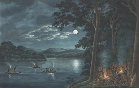
Fishing by torchlight Joseph Lycett, c.1817 · original held by the National Library of Australia (nla.pic-an2962715-s8)
The colonial river
1797
Shortland finds the river's mouth
Lieutenant John Shortland, pursuing escaped convicts, charts the Hunter's mouth. Coal and cedar begin shipping to Sydney soon after.
1801
“Ash Island” gets its name
Lt. Col. Paterson surveys the river. The name Ash Island is first given, after trees resembling the English ash, and Ensign Barralier draws the first map. A sawpit is already working on the island.
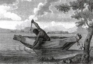
The Voyage of Discovery From Lt Grant's account, published 1803
The Scott era
1827
A.W. Scott takes up Ash Island
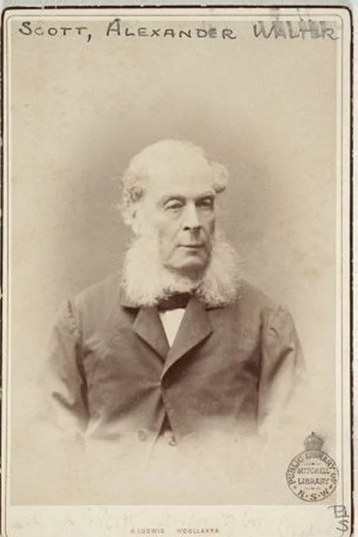
Alexander Walker Scott (entomologist, entrepreneur, later a trustee of the Australian Museum) acquires his Ash Island estate and plants an orange orchard. His oranges become famous throughout the colony.
A.W. Scott Photograph held by the Mitchell Library, State Library of NSW1828
The census counts the tribes
“The 1828 Census records the total indigenous population as 260. Newcastle: Coal River Tribe — 50 men 40 women 50 children and Ash Island Tribe — 40 men 35 women 45 children.”
Cherylanne Bailey and Beatrice Brooks, Indigenous Inhabitants of the Hunter River Islands
“He mentioned in 1833 an elder named Wallungull, and in 1836, Muntorin a male of about 38 also two children Takkun and Toti their ages about nine and seven.”
On the missionary Threlkeld's records, from the same page
1841
Conrad Martens draws the island
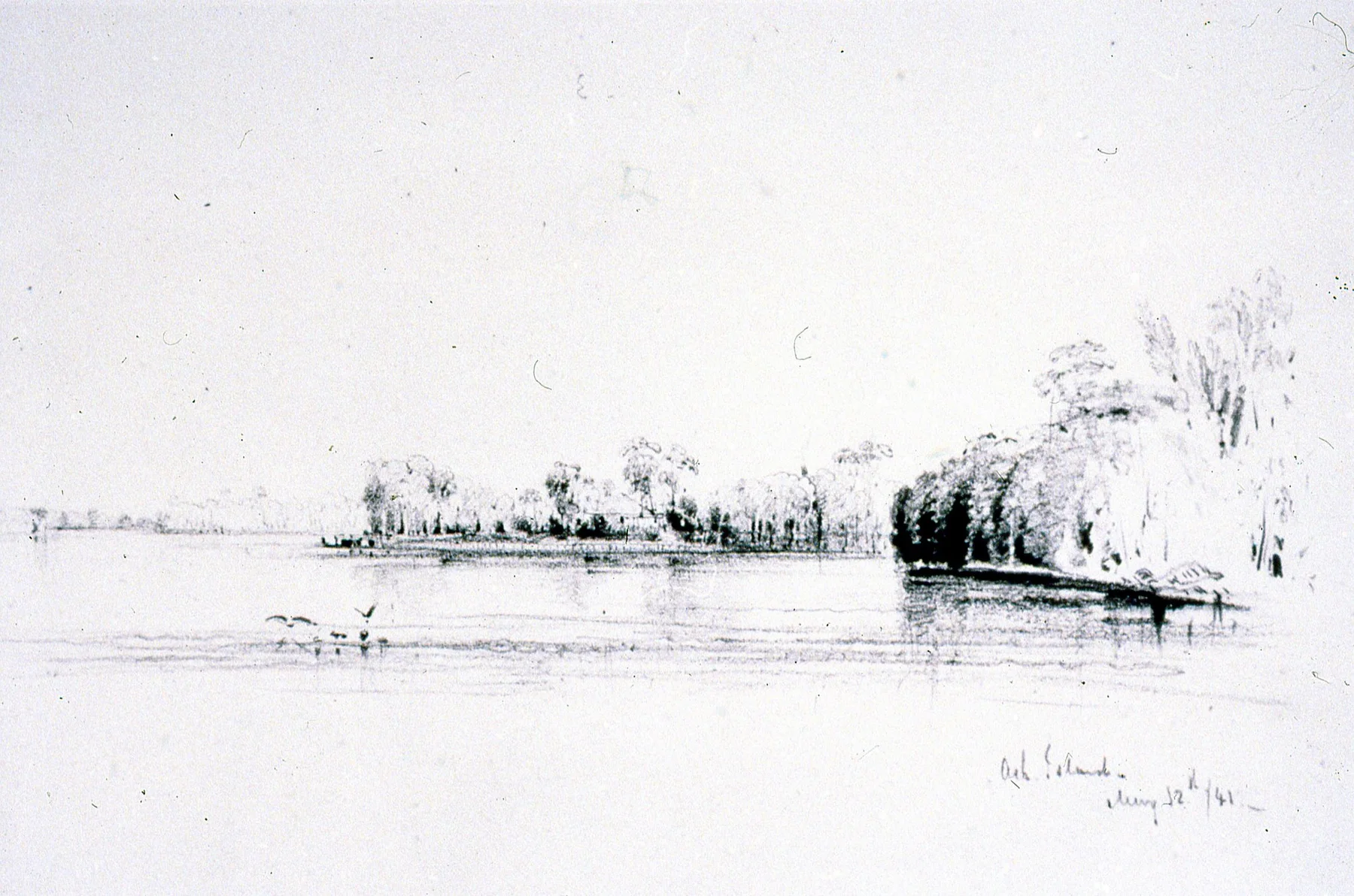
The colonial artist Conrad Martens sketches Ash Island from the river on 12 May 1841. Ludwig Leichhardt visits the next year and calls it “a remarkably fine place”; John and Elizabeth Gould come too.
Ash Island Conrad Martens, pencil, 12 May 18411845–46
Dairies begin; the Scotts move in
Dairy farming commences on the estuary islands, and the Scott family moves permanently to Ash Island, including two teenage daughters, Harriet and Helena, who will spend the next twenty years painting everything that grows, crawls and flies here.
1857
Flood years
Major floods strike in 1857 and again through the 1860s. Flood is the recurring fact of life on a low island in a big river.
1862
Helena Scott's Botany of Ash Island
Helena rambles over the island and records every plant she finds: an authoritative first-hand list that, 160 years later, is the reference for our replanting. The Plant Explorer is its descendant.
1864
Australian Lepidoptera is published in London
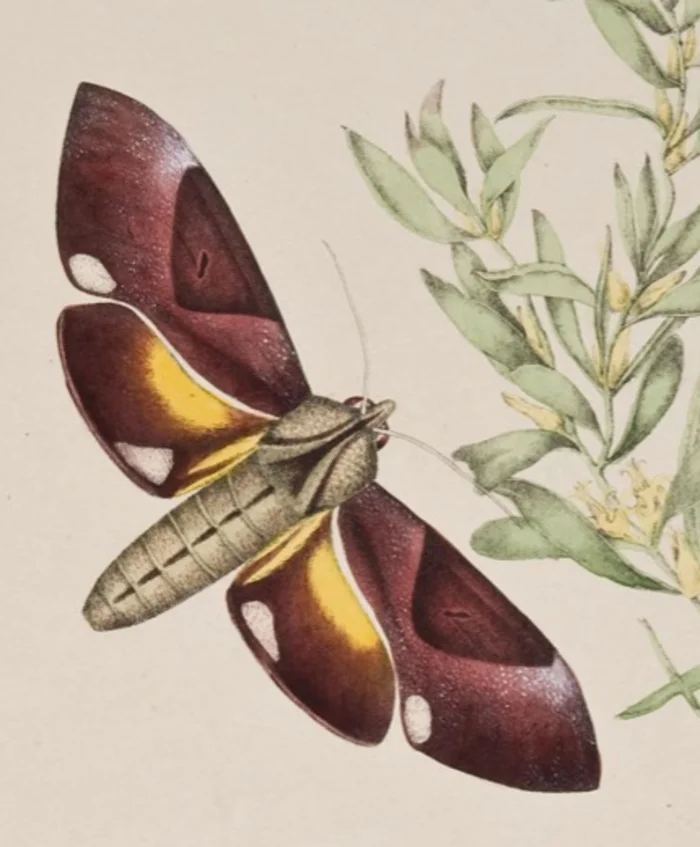
Australian Lepidoptera and Their Transformations (moths mostly by Harriet, butterflies by Helena, text by their father) reaches print. The same year, both sisters are elected honorary members of the Entomological Society of NSW, a rare tribute for women of their day. Their full story is here.
1866
The Scott farm fails
A.W. Scott is declared bankrupt and Ash Island is sold and subdivided into smaller farms. By the 1860s–70s the island supports seventeen dairies, fifty-five families and a school.
Farming families
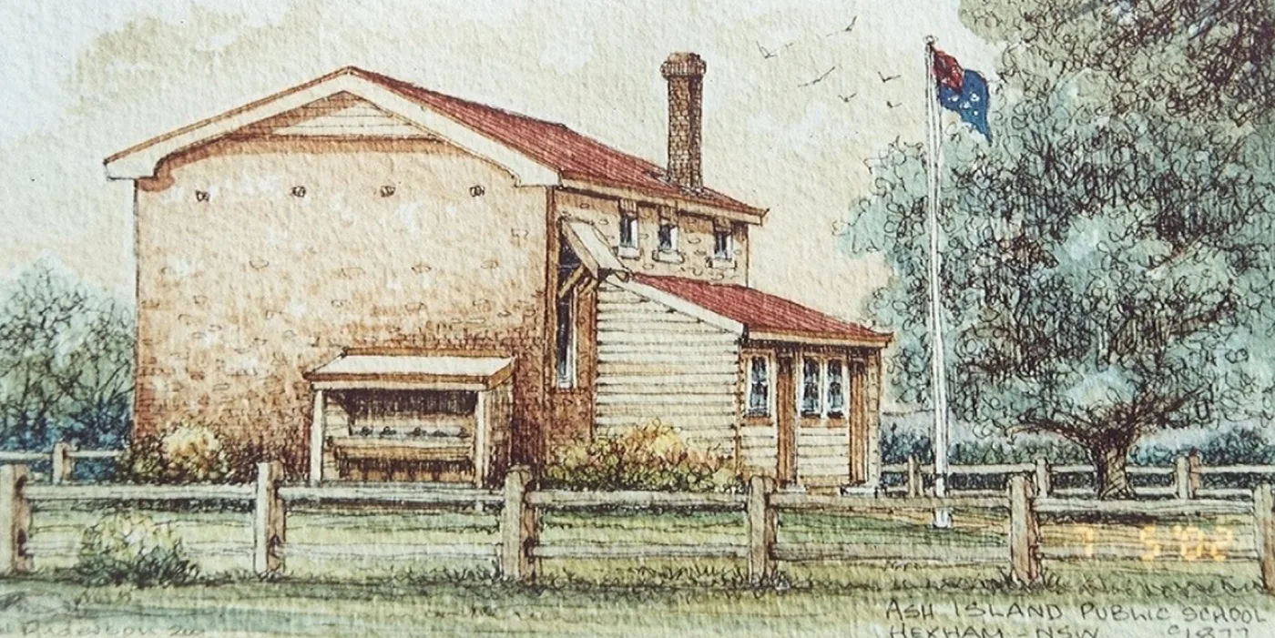
c.1877
Ash Island Public School
The school as a watercolour in our archive shows it, its inscription dated c.1877. In 1886 the District Inspector reports 220 people living on neighbouring Moscheto Island, 62 of them of school age.
Ash Island Public School, c.1877 Watercolour, inscription on work · FOTSH archive scan1893
The Great Flood
Residents take to their rooftops as water covers Ash Island six feet deep. The Milham family's herd of more than a hundred Alderney cows is all but wiped out; fourteen survive. Many farmers are ruined; the Milhams stay on. The Milham story is one of our archive's sample pages.
mid-1890s
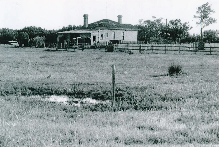
The Schoolmasters House is built
A sturdy double-brick residence goes up for the schoolmasters who administer and teach at the school a short walk to the west. It will become the last building in the estuary still standing on its original footprint. The house's own page is here.
The house in the farming years FOTSH archive1900s
Island life in photographs
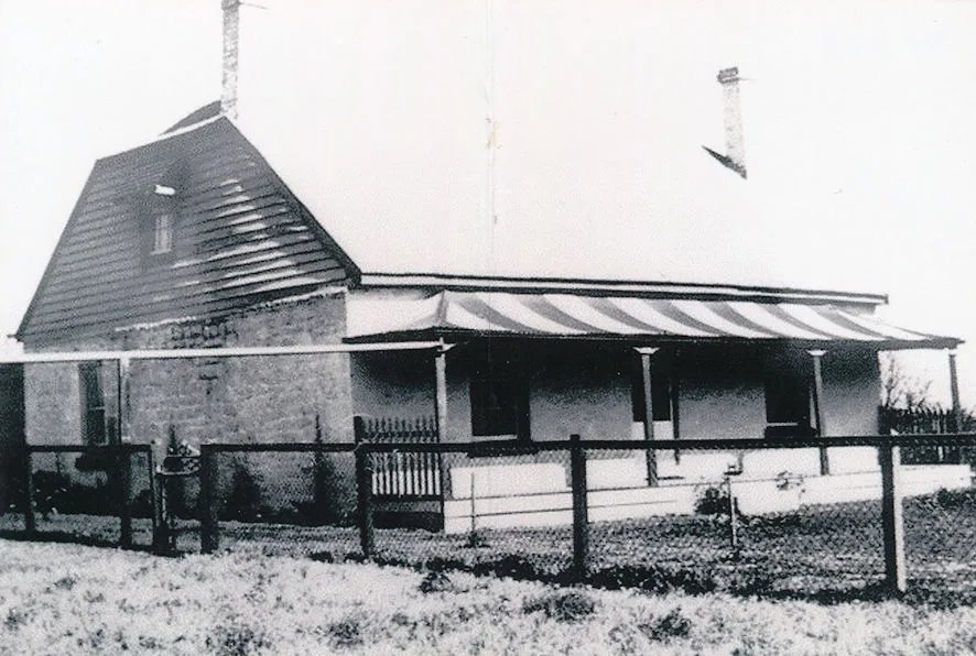
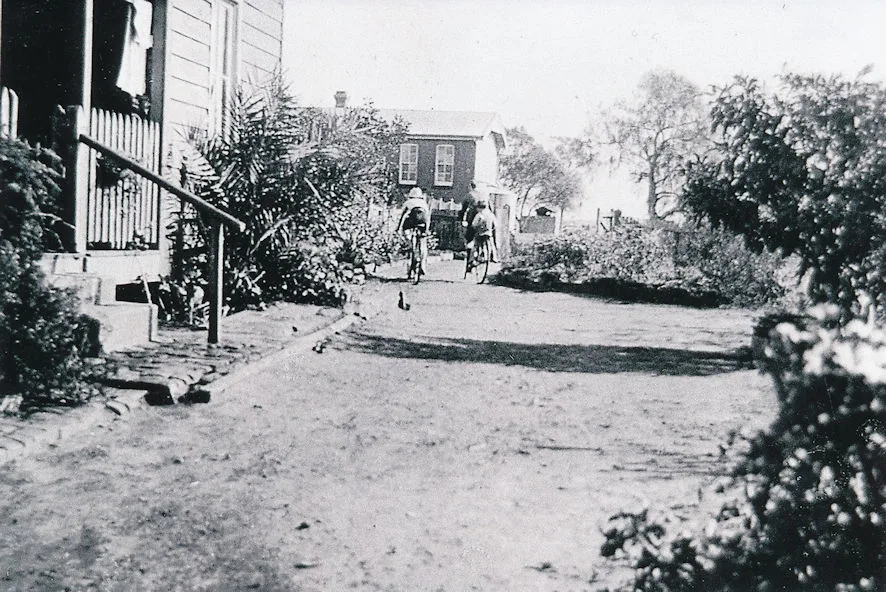
The archive's scanned photographs show the farming island as its families knew it: weatherboard farmhouses, striped verandah awnings, children on bicycles between the hedgerows.
Ash Island farmhouse FOTSH archiveOn the path FOTSH archive
Industry & war
1912–15
Steel comes to the estuary
The Newcastle Iron and Steel Works Act passes in 1912; BHP begins steel production on the harbour in 1915. The working port and the wetland have shared this estuary ever since.
1930
The weir
A weir is constructed between Hexham and Ash Islands, another step in a century of re-plumbing the estuary.
1942–46
131 Radar watches over Newcastle
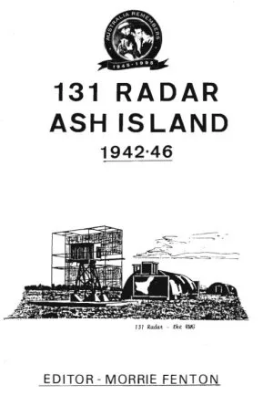
A small RAAF Ground Control Interception station forms on Ash Island in 1942, watching over Newcastle, then one of Australia's largest and most vulnerable war equipment factories. Its equipment is upgraded twice, ending with a Canadian GCI set housed in an almost impregnable concrete igloo operations room. By war's end the operator crews are almost entirely WAAAF, and the unit numbers fewer than fifty. The RAAF leases the Schoolmasters House through the war.
131 Radar Ash Island 1942–46 Editor: Morrie Fenton
The Newcastle Harbour Improvements Act sends resumption notices to the seventeen Ash Island families. The islands are to be joined into a single land mass for industry.
1955
The one-in-two-hundred-year flood
The great Hunter flood of 1955 sweeps the valley. The island becomes State-owned and is leased for grazing.
1958–68
The islands become Kooragang
Reclamation progressively joins the estuary islands, and in 1968 the NSW Geographical Names Board officially names the new landmass Kooragang Island. Ash Island survives as the local name for its northern half.
Reserve & restoration
1973
The pollution inquiry
The Coffey Inquiry into Pollution, the first under the State Pollution Control Commission Act, formally recognises the estuary's natural values.
1983–84
Nature reserve, then Ramsar
Kooragang Nature Reserve is gazetted in 1983 (it is now part of Hunter Wetlands National Park), and in 1984 Kooragang is declared a Ramsar wetland of international importance.
1993
KWRP begins
The Kooragang Wetland Rehabilitation Project is initiated to compensate for the loss of fish, shorebird and other wildlife habitat caused by two hundred years of draining, filling and clearing. The Schoolmasters House becomes its administration and information centre.
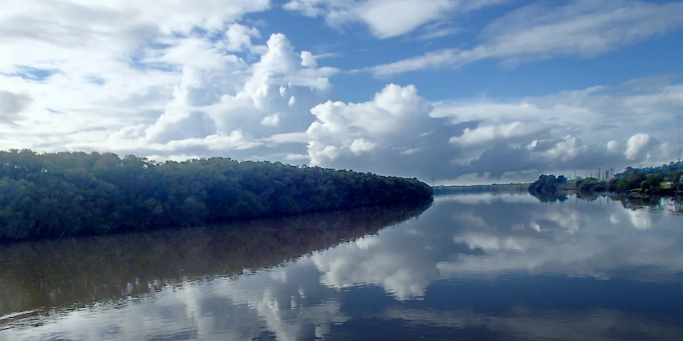
The estuary in the restoration years KWRP archive1995 →
200,000 trees and counting
Since 1995, over 200,000 trees and shrubs have been planted across the restoration areas. The planting continues on the third Sunday of every month; come and help.
Two hectares west of the radar bunkers are dedicated to planting chosen in consultation with local Aboriginal groups. The record of the day, in its authors' own words:
“‘Mur-rang Korung’ is from the local Kittang language and mean ‘Beautiful wilderness’. It is the name given to an area west of the radar bunkers where two hectares of land have been dedicated to planting with those plants chosen in consultation with local Aboriginal groups.” … “On July 25th 2003, the official launch of Mur-rang Korung was held. In conjunction with the local Aboriginal representatives, indigenous and non-indigenous schoolchildren started the planting of the new forest with about 500 trees. This was followed by a traditional ‘‘welcome to country’’ by the Worrimi. In addition, there was a ‘welcome dance’ performed by the dance group Girrawaa Yarruudanginya and this was seen as a feature of the day. Later more plants were added to this area by others making a total of 15 thousand. (KWRP Media documents 2003)”
From Indigenous Inhabitants of the Hunter River Islands, Cherylanne Bailey with Beatrice Brooks
1 July 2018
The Friends take the lease
When Hunter Local Land Services decides not to continue the lease on the old Schoolmasters House, we form, an incorporated and insured member of Landcare NSW, and take it on, so that the library of carefully measured and recorded information from the last 25 years is not dispersed. That work is what we do to this day.